DataLab’s geospatial team led by Geospatial Data Specialist, Michele Tobias, collaborates with researchers to produce publication-quality map graphics for inclusion in journal articles and books. Recent publications including cartography from the DataLab include:
- Charters, S., Demossier, M., Dutton, J., Harding, G., Maguire, J. S., Marks, D., & H., U. P. T. (2022). Routledge Handbook of Wine and Culture. Routledge.
- Grosglik, R. (2021). Globalizing organic. nationalism, neoliberalism, and Alternative Food in Israel. State University of New York Press.
- McCourt, D. M. (2021). Framing China’s rise in the United States, Australia and the United Kingdom. International Affairs, 97(3), 643-665.
- Nikos-Rose, K. M. (2021, December 2). Native girl’s remains returned to Alaska after more than a century. UC Davis.
- Plocharczyk, L., Conner, M. (2020). Libraries and Reading: Intellectual Disability and the Extent of Library Diversity. United Kingdom: Emerald Publishing Limited.
- Middleton Manning, B.R. (2018). Upstream: Trust lands and power on the Feather River. The University of Arizona Press.
- Smoodin, E. L. (2020). Paris in the dark: Going to the movies in the City of Light, 1930-1950. Duke University Press.
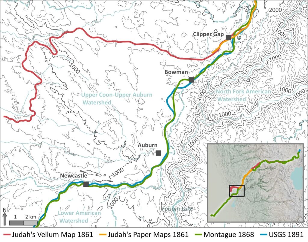
- Tobias, M. M., Bostic, D. J., & Sibbett, S. S. (2021). Route Logic of the Central Pacific Railroad, 1861–1869. California History, 98(2), 74–99. https://doi.org/10.1525/ch.2021.98.2.74
More information about DataLab’s cartographic services can be found on our Services Overview page.